Date: June 3
Start/ Stop: Salida, CO
Distance: 0
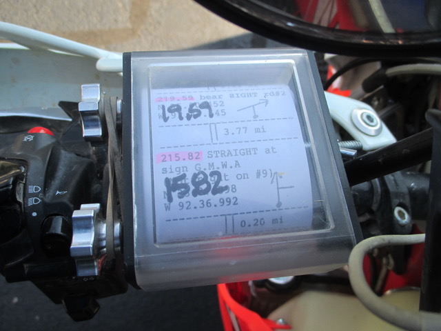
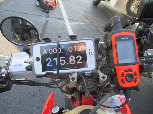
Highlights: Today was a service and maintenance day for both the bikes and the riders. They tightened, tweeked, mended and replaced parts and pieces of the bike. Dad thought it would be cool to show how they navigate along the way, so below is a picture of them looking at map notes and checking the road book and NAV.
Angel Tags: None.
Dad said:
Roll Chart (left side of the handle bars with hand written numbers) We load this every day and the numbers shown on the chart tell you when to turn, go straight, or a land mark to confirm location.
i-Phone (this is a GPS mileage when we come to a known location or corner) We use this as it is always going up and should help confirm your location and tell you when to turn.
Garmin has the GPS track for the TAT trail that we have loaded into GPS, that we confirm with the roll chart and GPS as we ride.
ie: If you look at the roll chart (15.82 on left of handle bars) and then look at the GPS milage on the i-Phone (215.82) The Garmin is a confirmation that I am headed the right location, and also to confirm that I am at the right place.
So if everything looks right, roll chart , GPS Milage, and track on the Garmin…. I then turn the roll chart to see the next turn, in this case it is at 19.59 and I turn Right. Every turn or marker you are confirming with GPS Mileage and the Garmin.
If the mileage is off, lets say that my GPS milage says 15.561 instead of 15.82… and I confirm my location as being correct on the Garmin… I will adjust my GPS milage on my iPhone to the correct 15.82 and look for my next turn at 19.59 (right)
This is happening at every turn, and we also have maps that confirm the roll charts, we only load the roll charts and carry the maps needed for that day.
Whew!


Comments